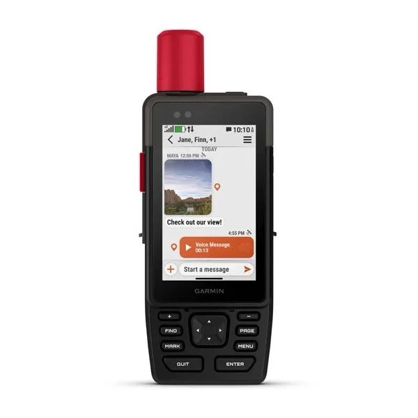
Garmin GPSMAP H1
Garmin
KES 75,000.00
Description
The Garmin GPSMAP H1 is a rugged handheld GPS navigator designed for hiking, camping, hunting, off-road adventures, and other outdoor activities. It features a bright, high-resolution touchscreen and advanced multi-band GNSS positioning for accurate navigation, even in challenging environments. With detailed TopoActive maps and a user-friendly interface, it helps you confidently navigate trails, roads, and remote areas.
Built for demanding outdoor conditions, the GPSMAP H1 has a durable, water-resistant construction and a long-lasting battery designed for extended adventures. It also supports wireless connectivity, allowing you to sync routes, update maps, and connect with compatible Garmin devices and smartphones. Its rugged design and reliable navigation features make it a practical choice for outdoor enthusiasts who need dependable GPS guidance.
Built for demanding outdoor conditions, the GPSMAP H1 has a durable, water-resistant construction and a long-lasting battery designed for extended adventures. It also supports wireless connectivity, allowing you to sync routes, update maps, and connect with compatible Garmin devices and smartphones. Its rugged design and reliable navigation features make it a practical choice for outdoor enthusiasts who need dependable GPS guidance.
Specifications
- Display: 3.5-inch transflective color TFT touchscreen — Provides clear visibility in different lighting conditions and supports easy map navigation. 282 × 470 pixels.
- GPS: Multi-band GNSS — Supports multiple satellite systems for accurate positioning, even in challenging environments.
- Maps: TopoActive maps — Includes detailed outdoor maps with routing and support for additional map downloads.
- Storage: 64GB internal memory — Provides space for maps, routes, activities, and other data.
- External Storage:: Supports up to 1TB microSD™ card — Allows additional storage for maps and data.
- Compass: 3-axis electronic compass — Helps provide accurate directional information, including when the device is tilted.
- Altimeter: Barometric altimeter — Measures elevation and helps track changes in altitude.
- Battery: Rechargeable lithium-ion — Provides up to 145 hours with all satellite systems and multi-band enabled, or up to 840 hours in Expedition Mode.
- Connectivity: Wi-Fi, Bluetooth and USB-C — Supports wireless syncing, map downloads, updates, and connection to compatible devices.
- Water Resistance: IP67 — Protected against dust and temporary water immersion up to 1 meter for 30 minutes.
- Durability: MIL-STD-810 — Designed to withstand thermal, shock, and water conditions.
- Dimensions: 2.6 × 7.0 × 1.3 inches — Rugged handheld design suitable for outdoor use.
- Weight: 276g (9.7 oz) — Lightweight enough for carrying during outdoor activities.
- Lens: Chemically strengthened glass — Provides added protection against scratches and everyday outdoor use.
- Charging Port: USB-C — Used for charging and data transfer.
- Color: Black — Rugged and understated finish.